Novgorod the Great was founded around 860, and by the 14th century had grown to be one of the largest cities in Europe and a powerful member of the Hanseatic League. It remained an independent economic might until the late 15th century, when Ivan III subjugated Novgorod to Moscow’s rule. At that time, it still had a large population of 35-40 thousand residents. This was ended by Ivan IV (“The Terrible”), who sacked Novgorod, slaughtered thousands of its citizens, and deported many of the wealthy and powerful citizens to Moscow and other locations. Its heyday may have ended with these events, but Novgorod still had treasures up its sleeve.
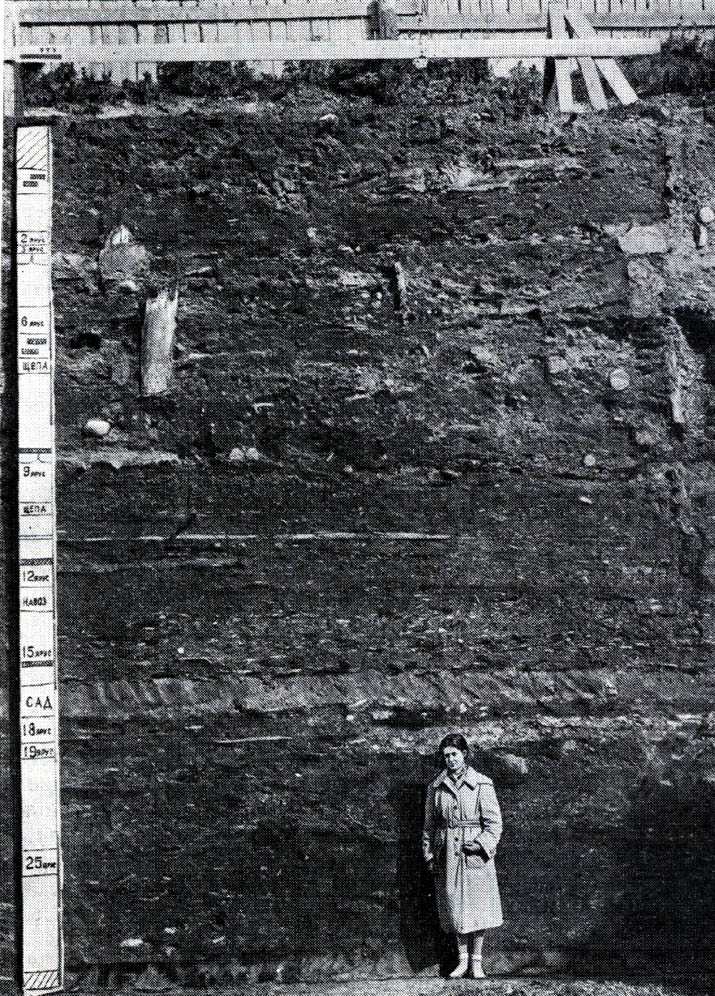
In medieval times, the city streets were “paved” with logs, and wooden sidewalks were constructed around and over the streets. Over time, these sank into the ground and were replaced with new logs, over and over, building up several centuries of layers of logs, as well as every-day items that were dropped, or involved in fires, etc. Many of the buildings in the city were likewise made of wood, which was well preserved by the marshy and acidic soil in the area. By dating the tree rings on the logs that remain, researchers have been able to very accurately determine the dates for each layer, and that allows us to determine when any ancillary items were interred. Since archeologists started digging from the top down, and layers were numbered as such, layers with lower numbers are from later periods in time, and layers with higher numbers are from earlier periods. The layers are dated as follows:
| Layer | Time Period |
|---|---|
| 28 | mid 10th century |
| 27 | 970s-980s |
| 26 | 990s |
| 25 | 1000-1025 |
| 24 | 1026-1050 |
| 23 | 1050-1060 |
| 22 | 1060s-1070s |
| 21 | 1070s-1080s |
| 20 | late 11th cent-1110s |
| 19 | 1110s-1120s |
| 18 | 1130s-1140s |
| 17 | 1150s-1160s |
| 16 | 1170s-1180s |
| 15 | 1180s-1200s |
| 14 | 1200s-1220s |
| 13 | 1220s-1240s |
| 12 | 1240s-23 May 1267 |
| 11 | 23 May 1267-1280s |
| 10 | 1280s-28 June 1311 |
| 09 | 28 June 1311-1342 |
| 08 | 1342-1368 |
| 07 | 1368-1394 |
| 06 | 1394-1414 |
| 05 | 1414-1440s |
| 04 | 1440s-1471 |
| 03 | 1471-early 16th cent |
| 02 | 1610s-1630s |
| 01 | mid 16th cent |
| 0 | second half of the 16th cent |
| 00 | late 16th century, turn of the 17th century |
Most finds from Novgorod are classified with a 3 digit identification, in “a-b-c” format, where:
a = the layer the item was found in. This can determine its age.
b = the plot where the item was found (more below)
c = the square within that plot where the item was found
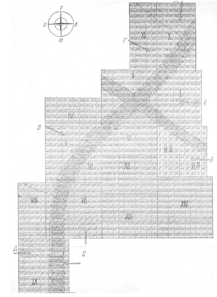
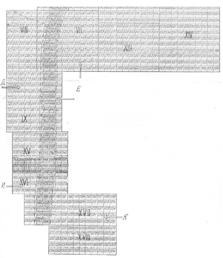
The plots are determined based on the following map, showing how extensive the digs in Novgorod have been, along several streets. These plot maps are from the 1951-1956 digs. More has, of course, been excavated since. By digging down through all the layers of a given plot, researchers have been able to determine where various kinds of workshops were located, including some that were in the same location for centuries, passed down from one generation to the next.